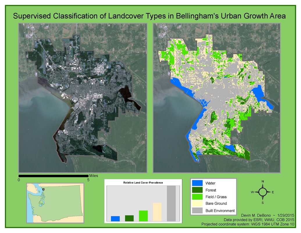
This map was created by performing a supervised classification of five land cover types within Bellingham, Washington's Urban Growth Area. This was achieved by first creating a natural color image from a Landsat Thematic Mapper scene.
First, this scene was clipped to a shapefile of the Bellingham UGA; this yielded a defined area on which to perform the classification. By selecting training points for each of the land cover types in question, I was able to create an index for the spectral signatures that corresponded to each individual cover type. The final product shows a classified scene of the Bellingham UGA and indicates the locales of each cover type.
First, this scene was clipped to a shapefile of the Bellingham UGA; this yielded a defined area on which to perform the classification. By selecting training points for each of the land cover types in question, I was able to create an index for the spectral signatures that corresponded to each individual cover type. The final product shows a classified scene of the Bellingham UGA and indicates the locales of each cover type.
 RSS Feed
